The Sacramento Hiking Trail - Port Elizabeth
- Port Elizabeth
Location
- Longitude: 25.533922
- Latitude: -34.040254
- Map
Rates Disclaimer
- Rates may vary and reduced rates may apply to additional persons. All rates are indicative only, may be seasonal and are subject to change without notice.
About The Sacramento Hiking Trail
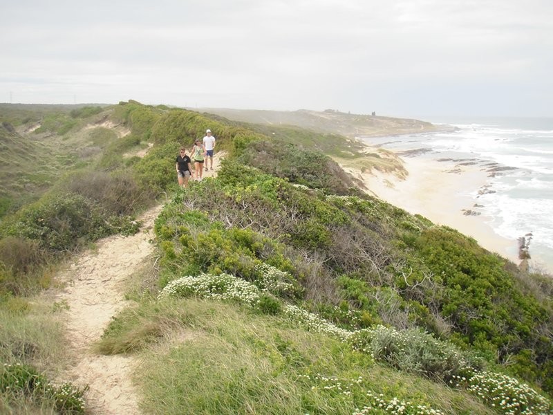
This trail of about 8 km traverses the 320 ha Sardinia Bay Nature Reserve proclaimed in 1980. The walk starts near the cannon at the west end of Schoenmakerskop and follows the coast to Sardinia Bay, returning via bridle-tracks and a path along the top of the vegetated dunes. The trail is suitable for moderately fit persons who are advised to walk in a group, wear stout shoes, take a sun hat and drinking water. Dogs are permitted on the lower (coastline) part of the trail.
At Schoenmakerskop a bronze cannon points towards the wreck of the Portuguese galleon Sacramento which foundered on 30 June 1647. Of the 72 survivors who reached the beach and set out to walk the 1,300 km back to Mozambique only nine reached Delagoa Bay (Maputo) on 5 January 1648. A mere four survived to sail back to return to Goa, the Portuguese colony in India. In 1977 local divers salvaged 40 bronze cannon from the wreck, including the one on display. These cannon had been cast in the Portuguese colony of Macau on the Pearl River estuary of China and were being shipped to Angola.
From the cannon the trail follows the coastline where numerous freshwater seepages can be seen. At the Sacramento monument can be seen one of two tall white beacons which mark the boundary of the adjacent Sardinia Bay Marine Reserve. This reserve was proclaimed in 1974 and exteds to Bushy Park in the west. The reserve comprises the area from the high water mark to 1 km out to sea. Removal of marine life is prohibited; this includes angling.
Sardinia Bay is the source of a 7,000 ha drift sands area stretching to Humewood. In the late 1800's the area was stabilised by dumping the city's refuse onto the dunes. Natural processes are nevertheless continually trying to re-establish the drift sands. Any disturbance of the sensitive pioneer dune vegetation, either by foot, vehicle or animals will lead to "blow-outs" which will eventually endanger roads and buildings.
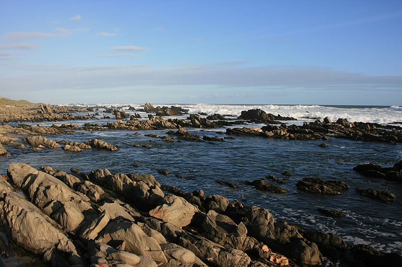
On the trail, at the far end of the sandy bay aptly named Cannon Bay, are the ruins of a mill used to crush seashells. The rocky strata along the coastline are of the Table Mountain Sandstone group and along this stretch of coast they jut out into the sea, creating sheltered gulleys that teem with juvenile fish. The terrestrial plant community among the rocks is able to cope with the sea spray and thin soil; Gazania and Tetragonia are among the more common. Out to sea gannets and dolphins can oftern be seen.
Sardinia Bay is a popular bathing beach with picnic facilities, an ablution block with drinking water and a lifesaving club. Views of the Sylvic Nature Reserve and Bushy Park to the west can be seen from above the bathing beach. Wind-stunted vegetation with trees such as Milkwood grow into low bushes and form part of the dense dune scrub while on the plateau areas fynbos is becoming established where extensive stands of alien Rooikrans and Port Jackson Willow have been cleared. Good views of the coastline can be enjoyed from the inland section of the trail which winds through fynbos back to Schoenmakerskop.
Please note that use of the area is at your own risk.
Map and Directions to The Sacramento Hiking Trail
GPS : 34° 2' 24.91" S / 25° 32' 2.12" E
From the central or seaside parts of the city
Continue on Marine Drive right through the Cape Receife Nature Reserve until you reach Shoenmakerskop village. The trail starts at the far end of the village by the cannon.
From the west
From Buffelsfontein Road turn into Victoria Drive, next to Walmer location and follow this to the sea. Turn right into Marine Drive and drive to the end of Schoenmakerskop village where the trail starts at the cannon.